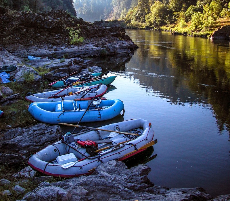
North Umpqua River flows
The flows represented by this gage station are in the North Umpqua River's Wild and Scenic Reach downstream of the North Umpqua Hydroelectric Project and Boulder Creek (a wilderness stream).
Real-Time flow data for this site is available from gage station 14316500 funded by PacifiCorp and managed by the USGS.
Forecasted flows for a nearby tributary, Steamboat Creek, are provided by NOAA's Northwest River Forecast Center.

Tentative 2025 schedule of planned waterway activity which may affect flow in bypass reaches or trigger a fish salvage at the North Umpqua Hydroelectric Project. Maintenance has been planned to occur during the Settlement Agreement preferred periods to the greatest extent possible. Dates are tentative and can change without notice due to weather, access, equipment, personnel, and other issues. The dates listed are the approximate range when flow changes are anticipated, but flow management may impact adjacent days as well. During some outages it may be possible to keep “fish flow” in the waterway, which means sufficient flow to keep fish alive, generally 2-20 cfs depending on the waterway, season, and weather. Note also that high natural flows and unplanned shutdowns for emergency responses and brief maintenance events may occur at any time without advance notice. For details contact Rich Grost, PacifiCorp, 541-498-2617. Version 2025v4; 5/29/25.
Waterway |
Approximate dates of shutdown |
Bypass reach flow affected? |
Date of fish salvage |
Fish liberated to |
Notes |
|---|---|---|---|---|---|
| Lemolo 1 | 1/1 – 2/1 | Yes | N/A | N/A | Increased bypass reach flow to reduce downstream impact on plant trips |
Lemolo 1 |
6/2 - 20 |
Yes |
Yes | 6/3 | |
Lemolo 2 |
1/1 – 2/1 | Yes | N/A | N/A | Flume repairs ahead of schedule; fish salvages completed in October & December 2024 |
| Clearwater 1 | 10/22 – 11/14 | Yes | 10/22 | Clearwater 1 | |
| Clearwater 2 | 12/29/24 – 3/3/25 | Yes | No fish in canal |
N/A | Emergency repairs due to landslide into canal |
| Toketee (one turbine) |
1/1 – 10/31 12/7 – 12/19 |
When inflows exceed 900 cfs |
N/A | N/A | Two units remain online (this is mostly the Unit 2 rebuild begun in 2023 now thru 10-31-25) |
| Toketee (two turbines) | None planned | When inflows exceed 500 cfs | N/A | N/A | One unit remains online |
| Toketee (all three turbines) | None planned | Yes | N/A | N/A | No units operating; no salvage as fish screen precludes most fish from the confined tunnel which drains to river when dewatered |
| Fish Creek | 9/28 – 10/11, and whenever natural inflow <130 cfs | No | N/A | N/A | Fish screen precludes fish from canal; diversion is generally shut down most of the time especially in summer and fall due to low natural inflows |
| Slide Creek | 5/5 – 5/28 | Yes | 5/5-7 | Lemolo or Toketee reservoir | Fish released to Toketee Lake |
| Slide Creek | 6/2 - 8 | No* | N/A | N/A | Fish water retained in canal; *spill from forebay spillway instead of from diversion dam |
Soda Springs |
None planned | Fish screen precludes fish, penstock drains to river | |||
| Soda Springs fish passage facility | 8/4 – 8/28 | No | 8/6 | Adjacent waters | Tentative pending facility status after high-flow season; brown trout to Lemolo Lake if conditions allow it. |
Note that Lemolo and Toketee lakes are actually hydro project reservoirs, but their ‘geographic map name’ is ‘lake.’